Category:Disputed maps
Jump to navigation
Jump to search
Subcategories
This category has the following 6 subcategories, out of 6 total.
Pages in category "Disputed maps"
The following 13 pages are in this category, out of 13 total.
G
Media in category "Disputed maps"
The following 200 files are in this category, out of 1,462 total.
(previous page) (next page)-
1260MongolConquestsLevant.jpg 1,118 × 1,270; 121 KB
-
1300FrancoMongolOffensiveLevant.jpg 1,864 × 2,128; 376 KB
-
1744 full afsharid map.png 1,920 × 1,080; 460 KB
-
17ct map with current borders of Belarus.jpg 3,968 × 3,363; 4.43 MB
-
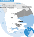
181-Yemengo gatazka.svg 280 × 300; 319 KB
-
1861 р.. Ходзько Борейко Леонард Стан на 862 р.jpg 1,600 × 1,198; 553 KB
-
1974 U.S. Senate election in Alaska.svg 800 × 488; 1.67 MB
-
1ere pers sing.png 10,678 × 14,221; 35.33 MB
-
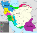
2004 Iran ethnoreligious distribution by the CIA (western Iran).jpg 913 × 1,325; 149 KB
-
2009 Iran ethnoreligious distribution by the CIA (detail of western Iran).png 1,241 × 1,839; 4.12 MB
-
2009 Wyoming Swine Flu.png 180 × 138; 3 KB
-
2017 GDP comparison by country or US state.png 6,288 × 3,248; 2.02 MB
-
2022 Indian Vice Presidential Election.svg 605 × 720; 285 KB
-
2022 Iran Protests (Killed) County.svg 1,208 × 1,142; 1.55 MB
-
3. Армянская Киликия в зеленом обрамлении.jpg 1,504 × 992; 1.48 MB
-
3e pers du sing neutre.png 8,221 × 9,733; 38.85 MB
-
4-AUG-1919.png 1,032 × 702; 160 KB
-
418px-NZ-kiwimapApteryx australis.png 418 × 599; 48 KB
-
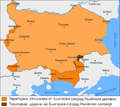
488px-Bulgarian-Wallachian-Empire.jpg 488 × 427; 227 KB
-
4KANARCHY30+ISAURIAN.png 3,840 × 2,160; 378 KB
-
645px-KangnidoCaption.jpg 775 × 720; 97 KB
-
807337 Continent-Asia.jpg 405 × 199; 26 KB
-
A37 (UK Road).png 234 × 407; 13 KB
-
Abraham Dharma.png 1,344 × 638; 45 KB
-
Abrahamic and Dharmic Map.png 6,194 × 3,291; 1.14 MB
-
Achaemenid Empire-ArtaxerxesIII conquest.png 250 × 165; 6 KB
-
Acprussiamap2.gif 510 × 357; 27 KB
-
Adinotherium range.png 360 × 359; 10 KB
-
Aegean Region in Turkey.svg 1,579 × 677; 1.67 MB
-
Afgempdur.jpg 364 × 359; 109 KB
-
Afghanistan - 2001.png 1,698 × 1,305; 71 KB
-
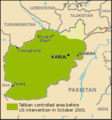
Afghanistan map taliban.png 331 × 355; 34 KB
-
Afghanistan unter Ahmad Schah Durrani.PNG 364 × 359; 60 KB
-
Africa - DPLA - 4abcc58a6d8824235e4028a0ddef7e9b.jpg 1,000 × 892; 200 KB
-
Africa HIV-AIDS 2002.svg 1,200 × 1,230; 79 KB
-
Africa road5.svg 1,138 × 1,339; 256 KB
-
Africa1940.png 4,200 × 2,916; 1.22 MB
-
Afroqueta capensis locator map.png 2,560 × 1,134; 11.09 MB
-
Afsharidempire.png 925 × 548; 30 KB
-
AfsharidEmpireIran.png 1,094 × 700; 17 KB
-
Age of Consent-2009-28-04.png 1,393 × 628; 42 KB
-
Age of Consent.png 1,393 × 632; 33 KB
-
Aghlabids Dynasty 800 - 909 (AD) - Arabic.svg 667 × 459; 198 KB
-
Aghlabids Dynasty 800 - 909 (AD)-pt.svg 667 × 459; 119 KB
-
Aghlabids Dynasty 800 - 909 (AD).svg 667 × 459; 92 KB
-
Agosto Septiembre 1936.png 459 × 380; 19 KB
-
Ahwaz Ethnic.png 3,064 × 4,184; 5.02 MB
-
Ahwaz Ethnics.png 5,704 × 4,184; 8.72 MB
-
Aire géographique de l'auvergnat d'après Pierre Bonnaud.gif 479 × 538; 11 KB
-
Airways.jpg 736 × 523; 49 KB
-
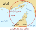
Al Qawasem Map.png 1,476 × 1,272; 725 KB
-
Alania 10th–12th c. according to Bzarov.png 1,656 × 1,281; 83 KB
-
Alborz Province Ethnic Map.png 720 × 412; 20 KB
-
Alca Members.PNG 1,357 × 620; 37 KB
-
Alianza del Pacífico 2014.png 863 × 443; 85 KB
-
Altmuehl2.png 812 × 864; 523 KB
-
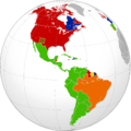
Americaslanguages.png 2,008 × 2,000; 513 KB
-
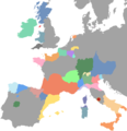
Amiseuropa.png 572 × 594; 17 KB
-
América latina.png 494 × 639; 10 KB
-
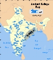
Ancient Kalinga location or.svg 1,639 × 1,852; 412 KB
-
Ancient Kalinga location.svg 1,639 × 1,852; 410 KB
-
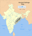
Ancient Kalinga map.png 1,280 × 1,446; 528 KB
-
Animali haragi moten kontsumoa..jpg 836 × 541; 124 KB
-
AnimatieGraniteRomania 1859-2010.gif 1,000 × 861; 3.33 MB
-
Antes01.png 1,243 × 966; 54 KB
-
António Costa foreign trips.svg 2,560 × 1,314; 1.3 MB
-
Aparanta.jpg 540 × 595; 30 KB
-
AppalachianLocatorMap2.png 637 × 424; 84 KB
-
Aquitani tribes map-fr.svg 878 × 750; 1.26 MB
-
Ar Iranethnics.png 2,295 × 2,048; 4.47 MB
-
Arab Kingdom of Syria.png 1,514 × 1,620; 1,004 KB
-
Arab Spring map2.gif 700 × 382; 47 KB
-
Arabia 1914-ar.png 976 × 821; 164 KB
-
Arabic alphabet world distribution.png 600 × 331; 16 KB
-
Arabic speaking world.png 323 × 248; 7 KB
-
Arabic Varieties Map.svg 2,051 × 1,151; 2.08 MB
-
ARD Landesrundfunkanstalten.svg 1,605 × 1,465; 880 KB
-
Ardabil Province Ethnic Map.png 967 × 1,325; 47 KB
-
Argentina - DPLA - 54617fd07edcbb8a4c17ea7228233a15.jpg 5,496 × 9,336; 4.15 MB
-
Argentina admin location map.svg 1,276 × 2,149; 849 KB
-
Argentina Administrative Divisions CIA World Factbook.jpg 781 × 1,325; 187 KB
-
Argentina Administrative Divisions.jpg 781 × 1,325; 194 KB
-
Argentina Blank Map.svg 465 × 1,085; 99 KB
-
Argentina blank.svg 525 × 1,015; 185 KB
-
Argentina HDI.png 2,000 × 4,280; 100 KB
-
Argentina provinces blank 2.png 520 × 1,004; 17 KB
-
Argentina provinces blank.png 2,000 × 4,280; 44 KB
-
Argentina provinces by HDI.png 2,000 × 4,280; 248 KB
-
Argentina provinces by population 2010.png 534 × 973; 34 KB
-
Argentina-gobernadores electos por partido.png 2,000 × 4,280; 139 KB
-
Argentina-locator.png 310 × 451; 4 KB
-
Argentina. LOC 2005631601.jpg 2,534 × 3,139; 836 KB
-
Argentina. LOC 2005631601.tif 2,534 × 3,139; 22.76 MB
-
Argentina. LOC 96685208.jpg 2,491 × 3,150; 818 KB
-
Argentina. LOC 96685208.tif 2,491 × 3,150; 22.45 MB
-
Argentine Provinces by HDI 2012.png 280 × 599; 54 KB
-
Arh.location.map.numbered.png 500 × 458; 19 KB
-
Arh.location.map.PNG 500 × 458; 14 KB
-
Armenia Greece Locator.png 993 × 595; 13 KB
-
Armenia in 70 BC.png 1,280 × 842; 117 KB
-
Arosia.jpg 525 × 350; 54 KB
-
Asia Countries Flag Map.png 2023.png 2,560 × 1,948; 779 KB
-
Asia Countries Flag Map.png.2023.png 2,560 × 1,948; 779 KB
-
Asian and European Russia.png 6,576 × 3,990; 1.51 MB
-
AtHistEur1250b.jpg 1,317 × 1,445; 259 KB
-
AtlBalkrelig.jpg 318 × 327; 173 KB
-
Australiformis Distribution.png 2,300 × 1,382; 321 KB
-
Austria locator map (1000).svg 1,875 × 1,815; 5.74 MB
-
Austria Mauthausen sub-camps.png 900 × 487; 915 KB
-
Austria-Hungary map new.svg 783 × 605; 245 KB
-
Austria-Hungary map ua.svg 783 × 605; 317 KB
-
Austria-Hungary map.svg 783 × 605; 331 KB
-
Average yearly temperature (°C).png 7,192 × 4,518; 2.54 MB
-
Avrupa Hun Haritası - Hunnic Empire.png 1,080 × 1,080; 1.27 MB
-
Azerbaijan Ethnic Map.png 2,397 × 2,052; 98 KB
-
Azerbaijan regions (fr).png 836 × 733; 165 KB
-
Azerbaijani languages.PNG 655 × 505; 38 KB
-
Azerbaijani people in Middel East.jpg 1,100 × 850; 359 KB
-
Azerbaijanians in Caucasus.jpg 550 × 590; 49 KB
-
Azerbajaniethnicity-Iranethnicmap.PNG 895 × 823; 41 KB
-
B26056113B - India orientalis.jpg 3,866 × 3,091; 3.06 MB
-
Bagratuni Armenia 1000-hy.svg 2,717 × 1,595; 767 KB
-
Baku Formula One circuit map.png 2,560 × 1,897; 562 KB
-
Balotage2015TierraDelFuego.png 670 × 349; 35 KB
-
Banate of Kulin.png 940 × 710; 194 KB
-
Banate of Matej Ninoslav.png 940 × 710; 195 KB
-
Banate of Pavao Shubic.png 940 × 710; 196 KB
-
Banate of Stjepan II.png 940 × 710; 197 KB
-
Banate of Tvrtko I.png 940 × 710; 201 KB
-
Banet Panades Nautical chart Mediterranean 1557.jpg 3,008 × 2,000; 2.33 MB
-
Bani sakher enlarged map.jpg 2,000 × 2,000; 568 KB
-
Bani sakher focused map.jpg 500 × 500; 77 KB
-
Barclays group worldwide locations.png 1,800 × 820; 110 KB
-
Bases aeriennes France 2013.jpg 940 × 917; 131 KB
-
Bashkir-khaganate-map.png 848 × 498; 890 KB
-
Battle of Ongal plan.png 1,311 × 1,372; 542 KB
-
Bavaria locator map (1000).svg 4,431 × 3,875; 4.7 MB
-
Bay-of-Piran maritime-boundary-dispute.jpg 709 × 600; 160 KB
-
Bayern im 10.Jh.png 663 × 368; 100 KB
-
Bayern um 788.png 663 × 368; 106 KB
-
Belgorod in Ukraine.png 1,600 × 1,074; 322 KB
-
Belgorod in Ukraine.svg 1,547 × 1,041; 480 KB
-
Belize Base Map.png 2,380 × 3,145; 171 KB
-
Bengal (orthographic projection).svg 581 × 581; 532 KB
-
Bengal in 1947 Partition of Bengal.svg 3,333 × 2,067; 1.81 MB
-
BG-ХІV.jpg 1,280 × 845; 260 KB
-
Bhutan in its region.svg 372 × 209; 6.86 MB
-
BiH - Bosanska Krajina.PNG 326 × 350; 22 KB
-
BiHDemo2006.png 1,600 × 1,520; 113 KB
-
Black rat range map.png 347 × 167; 2 KB
-
Black Sea Region in Turkey.svg 1,579 × 677; 1.67 MB
-
Blank map of Europe in 1920.svg 841 × 732; 541 KB
-
Blank map of Russia (2022).svg 1,052 × 744; 42 KB
-
BosniaksToday hu.svg 680 × 564; 115 KB
-
BosniaksToday.svg 680 × 564; 115 KB
-
Bosnian core.png 940 × 710; 193 KB
-
Bourgmestre-Evere-2006.png 1,000 × 1,040; 218 KB
-
Bourgmestre-Evere-2012.png 1,000 × 1,040; 193 KB
-
Bourgmestre-Région Brux Capitale-2006.png 1,000 × 1,040; 217 KB
-
Bourgmestre-Région Brux Capitale-2012.png 1,000 × 1,040; 136 KB
-
Brihadratha Empire.jpg 720 × 677; 426 KB
-
Britain 500 CE.png 1,149 × 829; 731 KB
-
British Empire and Commonwealth 1939.xcf 1,425 × 625; 142 KB
-
British Empire and Commonwealth 1945.xcf 1,425 × 625; 148 KB
-
Brown rat distribution.png 1,357 × 628; 22 KB
-
Brussels EU.svg 388 × 404; 14 KB
-
Brussels-Capital Region blank stylised.svg 404 × 420; 209 KB
-
Brussels-Capital Region blank.svg 404 × 420; 202 KB
-
Bruxelles-Capitale.svg 404 × 420; 209 KB
-
Bruxelles-Capitale2.svg 404 × 420; 209 KB
-
Bruxelles-Capitale3.svg 404 × 420; 209 KB
-
Buddhism By Country Numbers (2004).png 1,357 × 628; 66 KB
-
Buddhist population numbers.png 1,357 × 628; 119 KB
-
Bulgari bessarabi Bessarabian Bulgarian.png 473 × 447; 13 KB
-
Bulgari bessarabi.png 4,589 × 3,296; 1.27 MB
-
Bulgaria Accurate map.png 1,920 × 863; 394 KB
-
Bulgaria after Treaty of Neuilly-sur-Seine.png 3,574 × 3,201; 694 KB
-
Bulgarian Folklore Map 2 RU.png 800 × 537; 787 KB
-
Bulgarians in Romania.png 819 × 576; 212 KB
-
Bulgaro stati giuridici.png 2,826 × 2,352; 1.04 MB
-
Bushehr Province Ethnic Map.png 2,720 × 1,600; 162 KB
-
Béni Imloul 2.jpg 368 × 514; 55 KB
-
Bản đồ Lĩnh Nam thời Trưng Vương-Hai Bà Trưng.jpg 587 × 488; 89 KB
-
Caffa and Theodoro 2.svg 996 × 660; 350 KB
-
California State Route 123 Map.svg 1,028 × 609; 2.74 MB
-
Calomera littoralis range map.png 2,743 × 1,392; 483 KB
-
Cameroon border changes.svg 1,112 × 1,408; 250 KB
-
Cameroun 1901-1916.png 1,332 × 848; 77 KB
-
Camino Español.PNG 323 × 569; 110 KB
-
CAN 2012 QF 2.png 596 × 600; 86 KB
-
CAN 2012 QF.png 596 × 600; 78 KB
-
Cannabis law by region.png 1,480 × 625; 52 KB
-
Cannabis law worldwide.png 1,480 × 625; 47 KB
-
Carolingian and Byzantine Empires 814.png 3,840 × 2,258; 700 KB
-
Carte - Le Proche-Orient en 1095.svg 744 × 1,052; 161 KB




.jpg/83px-2004_Iran_ethnoreligious_distribution_by_the_CIA_(western_Iran).jpg)
.png/81px-2009_Iran_ethnoreligious_distribution_by_the_CIA_(detail_of_western_Iran).png)


_County.svg/120px-2022_Iran_Protests_(Killed)_County.svg.png)


.png/69px-A37_(UK_Road).png)






_-_Arabic.svg/120px-Aghlabids_Dynasty_800_-_909_(AD)_-_Arabic.svg.png)
-pt.svg/120px-Aghlabids_Dynasty_800_-_909_(AD)-pt.svg.png)
.svg/120px-Aghlabids_Dynasty_800_-_909_(AD).svg.png)














.svg/120px-Austria_locator_map_(1000).svg.png)


.png/120px-Average_yearly_temperature_(°C).png)

.png/120px-Azerbaijan_regions_(fr).png)


.svg/120px-Bavaria_locator_map_(1000).svg.png)


.svg/120px-Bengal_(orthographic_projection).svg.png)




.svg/120px-Blank_map_of_Russia_(2022).svg.png)




.png/120px-Buddhism_By_Country_Numbers_(2004).png)


